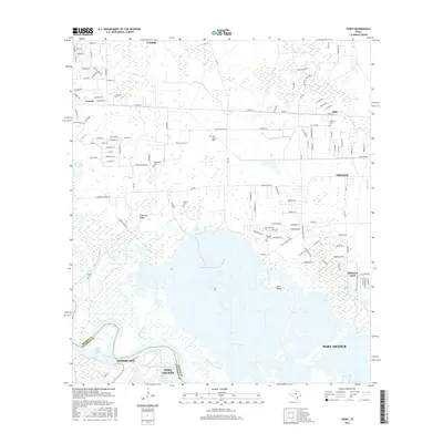
2016 Map of Terry
USGS Topo · Published 2016About this map
The low-lying wetlands and industrial waterways of the Texas Gulf Coast define this landscape where the Neches River meets the intricate marshlands of Orange and Jefferson counties. In this 2016 survey, the interaction between established riverfront communities like Nederland and Port Neches and the surrounding coastal prairie is clearly visible. For genealogists, the map identifies numerous small family and community burial sites, including the Kishi Colony Cem and the Adcock Cem, which sit amidst the residential expansions of Vidor and Oilla. The southern portion of the sheet is dominated by the sprawling waters of the river and Gum Island, intersected by navigation improvements like the Smith Bluff Cutoff. This network of bayous, such as Cow Bayou and Bird Island Bayou, illustrates the complex drainage and transportation systems essential to the region's maritime and industrial economy.
Find a feature on this map
36 named features on this map. Tap any name to fly to it.
Don’t see what you’re looking for? This feature index may not catch every label — zoom into the map to look around manually.
Map Details
Editions of this 2016 Terry Map
This is the sole edition of this map. No revisions or reprints were ever made.
Other maps of this area

1926 · Terry
USGS Topo · 1:24,000

1926 · Lakeview
USGS Topo · 1:24,000

1926 · Vidor
USGS Topo · 1:24,000

1926 · Texla
USGS Topo · 1:24,000

1926 · Mauriceville
USGS Topo · 1:24,000

1932 · Beaumont
USGS Topo · 1:62,500

1932 · Port Arthur NE
USGS Topo · 1:31,680

1943 · West of Greens Bayou
USGS Topo · 1:24,000

1943 · Orangefield
USGS Topo · 1:24,000

1943 · Mauriceville
USGS Topo · 1:24,000