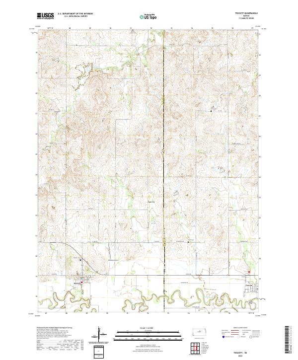
2022 Map of Tescott
USGS Topo · Published 2022About this map
Tescott and Beverly occupy the southern reaches of this landscape where the meandering Saline River cuts across the plains. The terrain is defined by a dense network of sectional roads, such as Kiowa Rd and Coronado Rd, which provide access to rural agricultural lands and homesteads. Local history is anchored by several burial grounds, including Spring Creek Cem, Twin Hills Cem, Price Cem, and Beverly Cem, which serve as quiet markers of the region's long-established settlement patterns. The presence of Hillbillies Airport near the border of Lincoln and Ottawa Counties highlights the integration of light aviation into this Kansas landscape. Small-town infrastructure is visible in the grid of Beverly, while the natural drainage of Spring Cr feeds into the main river valley below.
Find a feature on this map
35 named features on this map. Tap any name to fly to it.
Don’t see what you’re looking for? This feature index may not catch every label — zoom into the map to look around manually.
Map Details
Editions of this 2022 Tescott Map
This is the sole edition of this map. No revisions or reprints were ever made.
Other maps of this area

1892 · Salina
USGS Topo · 1:125,000

1892 · Minneapolis
USGS Topo · 1:125,000

1894 · Ellsworth
USGS Topo · 1:125,000

1894 · Beloit
USGS Topo · 1:125,000

1942 · Salina
USGS Topo · 1:125,000

1955 · Culver
USGS Topo · 1:24,000

1955 · Manhattan
USGS Topo · 1:250,000

1955 · Great Bend
USGS Topo · 1:250,000

1955 · Hutchinson
USGS Topo · 1:250,000

1955 · Beloit
USGS Topo · 1:250,000