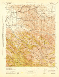
1943 Map of Tesla
USGS Topo · Published 1943About this map
The Livermore Valley and the formidable ridges to the east define this landscape, where the Southern Pacific and Western Pacific railroads converge at Altamont. This corridor represents a critical transit point through the Coast Ranges, marked by the steep ascent of Patterson Pass. While the valley floor is organized by a grid of roads like East Ave and Taylor Ave, the surrounding uplands remain sparsely settled, dominated by livestock operations and isolated outposts such as Mendenhall Ranch and Pointers Homestead.
Find a feature on this map
58 named features on this map. Tap any name to fly to it.
Don’t see what you’re looking for? This feature index may not catch every label — zoom into the map to look around manually.
Map Details
Editions of this 1943 Tesla Map
This is the sole edition of this map. No revisions or reprints were ever made.
Other maps of this area

1889 · San Jose
USGS Topo · 1:62,500

1896 · Mt. Diablo
USGS Topo · 1:62,500

1897 · San Jose
USGS Topo · 1:62,500

1897 · Mt. Hamilton
USGS Topo · 1:62,500

1898 · Mt. Diablo
USGS Topo · 1:62,500

1899 · San Jose
USGS Topo · 1:62,500

1906 · Pleasanton
USGS Topo · 1:62,500

1907 · Tesla
USGS Topo · 1:62,500

1911 · Byron Hot Springs
USGS Topo · 1:31,680

1914 · Bethany
USGS Topo · 1:31,680