
1953 Map of Tetilla Peak
USGS Topo · Published 1954About this map
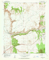
La Bajada Mesa dominates the landscape of this 1950s New Mexico survey, creating a dramatic geographic threshold where the high plains drop toward the Rio Grande valley. The historic El Camino Real and the Pan American Highway traverse the southern portion of the sheet, illustrating the enduring nature of this transportation corridor. Complex land tenure is visible through the overlapping boundaries of Spanish land grants, including the Caja del Rio Grant, La Majada Grant, and Santo Domingo Pueblo Grant.
Find a feature on this map
36 named features on this map. Tap any name to fly to it.
Don’t see what you’re looking for? This feature index may not catch every label — zoom into the map to look around manually.
Map Details
Editions of this 1953 Tetilla Peak Map
5 editions found
Other maps of this area

1892 · San Pedro
USGS Topo · 1:125,000

1892 · Santa Clara
USGS Topo · 1:125,000

1951 · Agua Fria
USGS Topo · 1:24,000

1951 · Turquoise Hill
USGS Topo · 1:24,000

1952 · Turquoise Hill
USGS Topo · 1:24,000

1952 · Montoso Peak
USGS Topo · 1:24,000

1953 · Cochiti Dam
USGS Topo · 1:24,000

1953 · Santo Domingo Pueblo
USGS Topo · 1:24,000

1953 · Agua Fria
USGS Topo · 1:62,500

1953 · Santo Domingo Pueblo
USGS Topo · 1:62,500