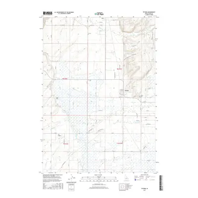
2017 Map of Tetonia
USGS Topo · Published 2017About this map
Tetonia and Felt anchor the northern reaches of the Teton Basin, a high mountain valley where agricultural tradition meets the drainages of the Teton Range. The landscape is defined by the braided path of the Teton River and a network of irrigation works, including the Hog Canal, which distribute water from creeks like Badger Cr and Spring Cr to the surrounding ranchlands. This 2017 survey details the contemporary rural infrastructure of the region, from established homesteads to new developments marked by roads such as Rising Sage Rd and Moose Path Way.
Find a feature on this map
52 named features on this map. Tap any name to fly to it.
Don’t see what you’re looking for? This feature index may not catch every label — zoom into the map to look around manually.
Map Details
Editions of this 2017 Tetonia Map
This is the sole edition of this map. No revisions or reprints were ever made.
Other maps of this area

1943 · Driggs
USGS Topo · 1:62,500

1943 · Garns Mtn
USGS Topo · 1:62,500

1946 · Driggs
USGS Topo · 1:62,500

1946 · Garns Mtn
USGS Topo · 1:62,500

1955 · Driggs
USGS Topo · 1:250,000

1958 · Driggs
USGS Topo · 1:250,000

1962 · Driggs
USGS Topo · 1:250,000

1965 · Lamont
USGS Topo · 1:24,000

1965 · Packsaddle Lake
USGS Topo · 1:24,000

1965 · Mc Renolds Reservoir
USGS Topo · 1:24,000