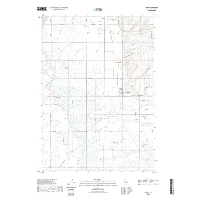
2020 Map of Tetonia
USGS Topo · Published 2020About this map
Tetonia and Felt anchor this high-altitude landscape where the agricultural traditions of the Teton Basin meet modern recreation routes. The geography is defined by a series of parallel watercourses flowing westward toward the Teton River, including Badger Cr, Spring Cr, and the three branches of N Leigh Cr, Middle Leigh Cr, and S Leigh Cr. A significant historical feature is the Yellowstone / Grand Teton Rail Trail, which traces the former railroad corridor north through the heart of the region. This transportation backbone once linked these small farming communities to larger markets. Local heritage is preserved at sites like Haden Cem, Felt Cem, and Clawson Cem, while the engineered Hog Canal illustrates the managed water systems necessary for high-desert cultivation. The transition from the flat basin floor into the rising elevations of Dry Hollow and the surrounding foothills provides a clear view of the area's physical development.
Find a feature on this map
75 named features on this map. Tap any name to fly to it.
Don’t see what you’re looking for? This feature index may not catch every label — zoom into the map to look around manually.
Map Details
Editions of this 2020 Tetonia Map
This is the sole edition of this map. No revisions or reprints were ever made.
Other maps of this area

1943 · Driggs
USGS Topo · 1:62,500

1943 · Garns Mtn
USGS Topo · 1:62,500

1946 · Driggs
USGS Topo · 1:62,500

1946 · Garns Mtn
USGS Topo · 1:62,500

1955 · Driggs
USGS Topo · 1:250,000

1958 · Driggs
USGS Topo · 1:250,000

1962 · Driggs
USGS Topo · 1:250,000

1965 · Lamont
USGS Topo · 1:24,000

1965 · Packsaddle Lake
USGS Topo · 1:24,000

1965 · Mc Renolds Reservoir
USGS Topo · 1:24,000