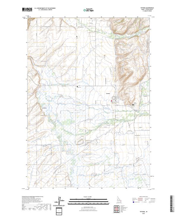
2023 Map of Tetonia
USGS Topo · Published 2023About this map
The Teton Basin dominates this landscape of the Idaho high country, where the Teton River and its numerous tributaries like Packsaddle Creek and Spring Creek create a complex network of wetlands and drainage. The settlement of Tetonia serves as a local hub, with its grid of streets including Jackson Ave and Leigh Ave surrounded by agricultural tracts. For those researching family history, the map includes three distinct burial sites: Felt Cem near the northern settlement of Felt, the centrally located Haden Cem, and the Cache Clawson Cem to the east.
Find a feature on this map
72 named features on this map. Tap any name to fly to it.
Don’t see what you’re looking for? This feature index may not catch every label — zoom into the map to look around manually.
Map Details
Editions of this 2023 Tetonia Map
This is the sole edition of this map. No revisions or reprints were ever made.
Other maps of this area

1943 · Driggs
USGS Topo · 1:62,500

1943 · Garns Mtn
USGS Topo · 1:62,500

1946 · Driggs
USGS Topo · 1:62,500

1946 · Garns Mtn
USGS Topo · 1:62,500

1955 · Driggs
USGS Topo · 1:250,000

1958 · Driggs
USGS Topo · 1:250,000

1962 · Driggs
USGS Topo · 1:250,000

1965 · Lamont
USGS Topo · 1:24,000

1965 · Packsaddle Lake
USGS Topo · 1:24,000

1965 · Mc Renolds Reservoir
USGS Topo · 1:24,000