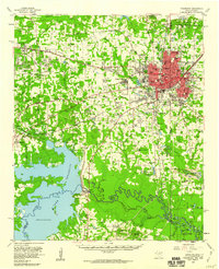
1954 Map of Texarkana
USGS Topo · Published 1960About this map
The bi-state hub of Texarkana serves as the focal point of this mid-century survey, illustrating the complex intersection of the Texas-Arkansas state line through the city's residential and commercial core. To the west, the massive footprint of the Red River Arsenal and the sprawling Lake Texarkana dominate the landscape, the latter held by the Lake Texarkana Dam across the Sulphur River. This era shows a region in transition, where new suburban developments like Wake Village and Nash contrast with the established agricultural patterns around Eylau and Redwater.
Find a feature on this map
84 named features on this map. Tap any name to fly to it.
Don’t see what you’re looking for? This feature index may not catch every label — zoom into the map to look around manually.
Map Details
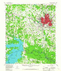
Editions of this 1954 Texarkana Map
2 editions found
Other maps of this area

1907 · Atlanta
USGS Topo · 1:62,500

1909 · New Boston
USGS Topo · 1:62,500

1909 · Texarkana
USGS Topo · 1:62,500

1910 · Linden
USGS Topo · 1:62,500

1910 · Atlanta
USGS Topo · 1:62,500

1950 · Redbank
USGS Topo · 1:24,000

1950 · Ogden
USGS Topo · 1:24,000

1950 · Barkman
USGS Topo · 1:24,000

1951 · Redbank
USGS Topo · 1:24,000

1951 · Ogden
USGS Topo · 1:24,000