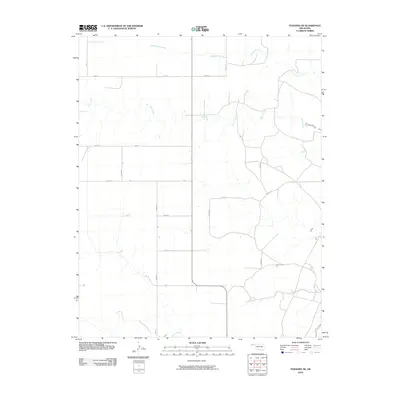
2010 Map of Texhoma NE
USGS Topo · Published 2010About this map
Tepee Creek and Spring Aroa Creek meander across this section of Texas County, highlighting the drainage patterns of the Oklahoma Panhandle. This landscape is defined by its expansive, grid-like rural road network, including arterial routes like Road S and Co Hwy 49. The map shows a region shaped by agricultural geometry, where section lines are strictly maintained by roads such as N0660 Rd and N0675 Rd. In the southern portion of the quadrangle, Sand Creek appears as it flows through the open plains. The scarcity of named settlements emphasizes the rural, wide-open character of this territory, where watercourses like Tepee Creek served as the primary natural landmarks for early surveyors and travelers navigating the high plains.
Find a feature on this map
23 named features on this map. Tap any name to fly to it.
Don’t see what you’re looking for? This feature index may not catch every label — zoom into the map to look around manually.
Map Details
Editions of this 2010 Texhoma NE Map
This is the sole edition of this map. No revisions or reprints were ever made.
Other maps of this area

1954 · Perryton
USGS Topo · 1:250,000

1958 · Perryton
USGS Topo · 1:250,000

1973 · Texhoma NE
USGS Topo · 1:24,000

1973 · Texhoma North
USGS Topo · 1:24,000

1973 · Goodwell NW
USGS Topo · 1:24,000

1973 · Eva SE
USGS Topo · 1:24,000
1973 · Texhoma SW
USGS Topo · 1:24,000

1973 · Hough SW
USGS Topo · 1:24,000
1973 · Texhoma NW
USGS Topo · 1:24,000

1973 · Goodwell
USGS Topo · 1:24,000