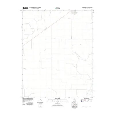
2010 Map of Texhoma South
USGS Topo · Published 2010About this map
Texhoma straddles the border region in this 2010 survey, serving as a primary focal point for the surrounding agricultural landscape. The township's layout is clearly defined in the north, while the vast remainder of the map is dominated by the geometric precision of the High Plains road grid. Key local routes such as Fm 119 and Myers Rd intersect various section roads including Co Rd C and Co Rd G, illustrating the systematic land division characteristic of the Oklahoma Panhandle.
Find a feature on this map
12 named features on this map. Tap any name to fly to it.
Don’t see what you’re looking for? This feature index may not catch every label — zoom into the map to look around manually.
Map Details
Editions of this 2010 Texhoma South Map
This is the sole edition of this map. No revisions or reprints were ever made.
Other maps of this area

1954 · Perryton
USGS Topo · 1:250,000

1958 · Perryton
USGS Topo · 1:250,000

1964 · Stevens SW
USGS Topo · 1:24,000

1965 · Stevens
USGS Topo · 1:24,000

1973 · Texhoma North
USGS Topo · 1:24,000
1973 · Texhoma SW
USGS Topo · 1:24,000

1973 · Goodwell
USGS Topo · 1:24,000

1974 · Sunray 1 NW
USGS Topo · 1:24,000

1974 · Texhoma South
USGS Topo · 1:24,000

1974 · Stevens SE
USGS Topo · 1:24,000