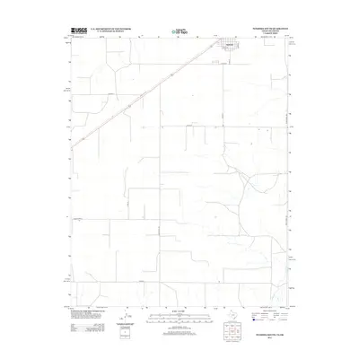
2012 Map of Texhoma South
USGS Topo · Published 2012About this map
Texhoma sits at the northern edge of this Panhandle landscape, where the street grid of E Main St and Coke St meets the expansive section lines of the Texas and Oklahoma borderlands. The terrain is defined by a rigorous grid of rural routes such as Co Road B and Co Road C, reflecting the large-scale agricultural operations and ranching heritage of the High Plains. Drainage patterns are subtle but present, most notably along the southern reach where Frisco Cr cuts through the open country. Transport across this border region relies on primary arteries like Ranch Road 119 and Ranch Road 1290, which connect the scattered homesteads and agricultural plots to the regional hub at the state line.
Find a feature on this map
14 named features on this map. Tap any name to fly to it.
Don’t see what you’re looking for? This feature index may not catch every label — zoom into the map to look around manually.
Map Details
Editions of this 2012 Texhoma South Map
This is the sole edition of this map. No revisions or reprints were ever made.
Other maps of this area

1954 · Perryton
USGS Topo · 1:250,000

1958 · Perryton
USGS Topo · 1:250,000

1964 · Stevens SW
USGS Topo · 1:24,000

1965 · Stevens
USGS Topo · 1:24,000

1973 · Texhoma North
USGS Topo · 1:24,000
1973 · Texhoma SW
USGS Topo · 1:24,000

1973 · Goodwell
USGS Topo · 1:24,000

1974 · Sunray 1 NW
USGS Topo · 1:24,000

1974 · Texhoma South
USGS Topo · 1:24,000

1974 · Stevens SE
USGS Topo · 1:24,000