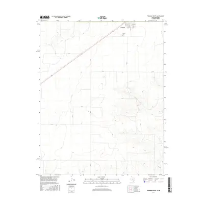
2016 Map of Texhoma South
USGS Topo · Published 2016About this map
Texhoma sits at the northern edge of this high-plains landscape, where the town grid transitions into a vast network of section roads across the Texas-Oklahoma border. The town's southern residential blocks, including streets like W Pearl St and W Denver St, anchor a region defined by agricultural utility and the diagonal passage of Highway 54. The terrain is marked by the winding course of Frisco Cr in the southeast, which provides a natural break in the otherwise rigid geometry of county roads such as Co Rd D and Co Rd F. This survey captures the rural infrastructure of the mid-2010s, including the local Texhoma Cem and the intersection of vital regional routes like Fm 119. Local historians will find the exact layout of peripheral farm-to-market roads and the distribution of drainage features useful for understanding the modern footprint of this border community.
Find a feature on this map
22 named features on this map. Tap any name to fly to it.
Don’t see what you’re looking for? This feature index may not catch every label — zoom into the map to look around manually.
Map Details
Editions of this 2016 Texhoma South Map
This is the sole edition of this map. No revisions or reprints were ever made.
Other maps of this area

1954 · Perryton
USGS Topo · 1:250,000

1958 · Perryton
USGS Topo · 1:250,000

1964 · Stevens SW
USGS Topo · 1:24,000

1965 · Stevens
USGS Topo · 1:24,000

1973 · Texhoma North
USGS Topo · 1:24,000
1973 · Texhoma SW
USGS Topo · 1:24,000

1973 · Goodwell
USGS Topo · 1:24,000

1974 · Sunray 1 NW
USGS Topo · 1:24,000

1974 · Texhoma South
USGS Topo · 1:24,000

1974 · Stevens SE
USGS Topo · 1:24,000