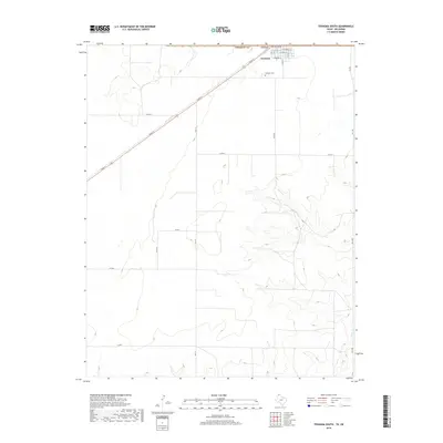
2019 Map of Texhoma South
USGS Topo · Published 2019About this map
The town of Texhoma straddles the high plains border between Oklahoma and Texas, serving as a focal point for this survey of the northern panhandle region. Historically established along the railway, the community’s grid extends south across the state line into Sherman Co, with residential streets like W Pearl St and S 5th St transitioning into an expansive agricultural landscape. This survey documents the intersection of rural infrastructure and natural drainage, where the headwaters and branches of Frisco Cr carve subtle relief into the terrain southeast of the town center.
Find a feature on this map
25 named features on this map. Tap any name to fly to it.
Don’t see what you’re looking for? This feature index may not catch every label — zoom into the map to look around manually.
Map Details
Editions of this 2019 Texhoma South Map
This is the sole edition of this map. No revisions or reprints were ever made.
Other maps of this area

1954 · Perryton
USGS Topo · 1:250,000

1958 · Perryton
USGS Topo · 1:250,000

1964 · Stevens SW
USGS Topo · 1:24,000

1965 · Stevens
USGS Topo · 1:24,000

1973 · Texhoma North
USGS Topo · 1:24,000
1973 · Texhoma SW
USGS Topo · 1:24,000

1973 · Goodwell
USGS Topo · 1:24,000

1974 · Sunray 1 NW
USGS Topo · 1:24,000

1974 · Texhoma South
USGS Topo · 1:24,000

1974 · Stevens SE
USGS Topo · 1:24,000