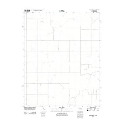
2011 Map of Texhoma SW
USGS Topo · Published 2011About this map
Beaver River and Sand Creek wind through the panhandle terrain of Texas County, defining the drainage patterns of this high plains agricultural landscape. The 2011 survey reveals a strictly organized section-line road system, where corridors such as Mile 3, Mile 4, and Mile 8 intersect with east-west routes like Co Hwy 51 and Co Hwy 53. This rigid grid reflects the Long-lot and Public Land Survey System typical of the region, providing a foundation for the scattered farmsteads and rural infrastructure. While primarily focused on topographic and hydrological features, the map provides precise locations for local transport routes, including Co Rd Dd and several numbered county roads like N0595 Rd and N0635 Rd. The meandering course of the riverbeds contrasts sharply with the human-made geometry of the surrounding Oklahoma-Texas borderlands.
Find a feature on this map
24 named features on this map. Tap any name to fly to it.
Don’t see what you’re looking for? This feature index may not catch every label — zoom into the map to look around manually.
Map Details
Editions of this 2011 Texhoma SW Map
This is the sole edition of this map. No revisions or reprints were ever made.
Other maps of this area

1954 · Perryton
USGS Topo · 1:250,000

1954 · Dalhart
USGS Topo · 1:250,000

1958 · Perryton
USGS Topo · 1:250,000

1958 · Dalhart
USGS Topo · 1:250,000

1962 · Dalhart
USGS Topo · 1:250,000

1964 · Stratford NE
USGS Topo · 1:24,000

1965 · Stevens
USGS Topo · 1:24,000

1971 · Griggs NE
USGS Topo · 1:24,000

1971 · Griggs
USGS Topo · 1:24,000

1973 · Texhoma NE
USGS Topo · 1:24,000