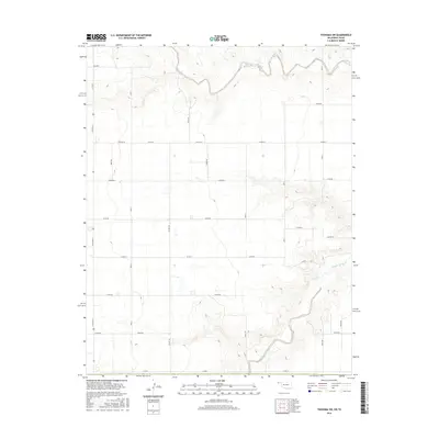
2016 Map of Texhoma SW
USGS Topo · Published 2016About this map
Beaver River and its accompanying Sand Creek tributary define the northern and southeastern drainage of this Oklahoma Panhandle landscape. The map shows a strictly gridded agricultural region in Texas County, structured by a network of county roads such as Mile 3 and N0595 Rd. This 2016 survey highlights the relationship between the natural watercourse of the river and the human-imposed geometry of the land, where major routes like Co Hwy 51 and Co Hwy 50 serve as primary connectors through the prairie. The topography reveals the subtle elevation changes where the plateau drops toward the riverbed, providing a clear view of the area's physical geography just before the border with Texas.
Find a feature on this map
28 named features on this map. Tap any name to fly to it.
Don’t see what you’re looking for? This feature index may not catch every label — zoom into the map to look around manually.
Map Details
Editions of this 2016 Texhoma SW Map
This is the sole edition of this map. No revisions or reprints were ever made.
Other maps of this area

1954 · Perryton
USGS Topo · 1:250,000

1954 · Dalhart
USGS Topo · 1:250,000

1958 · Perryton
USGS Topo · 1:250,000

1958 · Dalhart
USGS Topo · 1:250,000

1962 · Dalhart
USGS Topo · 1:250,000

1964 · Stratford NE
USGS Topo · 1:24,000

1965 · Stevens
USGS Topo · 1:24,000

1971 · Griggs NE
USGS Topo · 1:24,000

1971 · Griggs
USGS Topo · 1:24,000

1973 · Texhoma NE
USGS Topo · 1:24,000