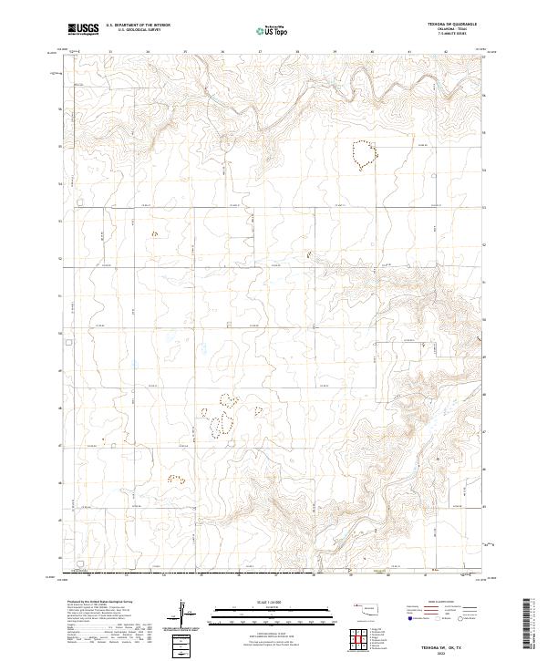
2022 Map of Texhoma SW
USGS Topo · Published 2022About this map
The Beaver River and Sand Creek meander across this High Plains landscape, where the state line between Oklahoma and Texas is defined by a strictly surveyed straight-line boundary. This 2022 survey illustrates a sprawling grid of rural section roads, including Co Rd Mi 2 and Mile 3, which serve a territory defined by large-scale agricultural activity and dispersed ranching. The transition between the Texas Panhandle and the Oklahoma Panhandle is marked by the Oklahoma Texas Co line, which cuts through several townships like t1n r10e and t1n r11e. A network of thoroughfares such as Co Hwy 51 and Co Hwy 50 connects these wide-open spaces, providing a detailed look at the modern infrastructure of this interstate borderland.
Find a feature on this map
35 named features on this map. Tap any name to fly to it.
Don’t see what you’re looking for? This feature index may not catch every label — zoom into the map to look around manually.
Map Details
Editions of this 2022 Texhoma SW Map
This is the sole edition of this map. No revisions or reprints were ever made.
Other maps of this area

1954 · Perryton
USGS Topo · 1:250,000

1954 · Dalhart
USGS Topo · 1:250,000

1958 · Perryton
USGS Topo · 1:250,000

1958 · Dalhart
USGS Topo · 1:250,000

1962 · Dalhart
USGS Topo · 1:250,000

1964 · Stratford NE
USGS Topo · 1:24,000

1965 · Stevens
USGS Topo · 1:24,000

1971 · Griggs NE
USGS Topo · 1:24,000

1971 · Griggs
USGS Topo · 1:24,000

1973 · Texhoma NE
USGS Topo · 1:24,000