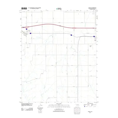
2012 Map of Texola
USGS Topo · Published 2012About this map
Texola sits at the western edge of Oklahoma on the border with Texas, defined by its relationship with the legendary Historic Route 66. This 2012 survey reveals the grid of the small settlement, including streets such as Texas Ave and Grand Ave, while the eastern portion of the map shows the outskirts of Erick. The landscape is dominated by a drainage network of creeks that cut through the plains, including Little Turkey Creek, Turkey Creek, and Bull Creek. Local history is anchored by the Texola Cemetery and Davis Cemetery, which serve as vital markers for genealogical research. The presence of Haddock Field Airport and the modern interstate corridor running parallel to the old highway route illustrates the shift from early motor travel to modern high-speed transportation through Beckham County.
Find a feature on this map
41 named features on this map. Tap any name to fly to it.
Don’t see what you’re looking for? This feature index may not catch every label — zoom into the map to look around manually.
Map Details
Editions of this 2012 Texola Map
This is the sole edition of this map. No revisions or reprints were ever made.
Other maps of this area

1954 · Amarillo
USGS Topo · 1:250,000

1955 · Clinton
USGS Topo · 1:250,000

1957 · Clinton
USGS Topo · 1:250,000

1958 · Amarillo
USGS Topo · 1:250,000

1960 · Sweetwater
USGS Topo · 1:62,500

1961 · Erick
USGS Topo · 1:62,500

1962 · Kelton SE
USGS Topo · 1:24,000

1963 · Fulller
USGS Topo · 1:24,000

1963 · Little Wolf Creek
USGS Topo · 1:24,000
1983 · Shamrock
USGS Topo · 1:100,000