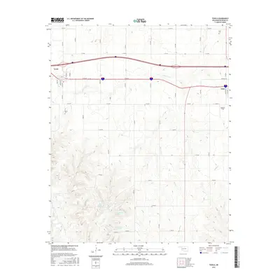
2016 Map of Texola
USGS Topo · Published 2016About this map
The border town of Texola stands at the western edge of Oklahoma in this modern survey, where the grid of Beckham County meets the Texas line. This landscape is defined by the drainage networks of Little Turkey Cr and Bull Cr, which carve through the plains toward the Red River watershed. The map details the local infrastructure of the 21st century, showing the small-town street plans of both Texola and the western portion of Erick.
Find a feature on this map
48 named features on this map. Tap any name to fly to it.
Don’t see what you’re looking for? This feature index may not catch every label — zoom into the map to look around manually.
Map Details
Editions of this 2016 Texola Map
This is the sole edition of this map. No revisions or reprints were ever made.
Other maps of this area

1954 · Amarillo
USGS Topo · 1:250,000

1955 · Clinton
USGS Topo · 1:250,000

1957 · Clinton
USGS Topo · 1:250,000

1958 · Amarillo
USGS Topo · 1:250,000

1960 · Sweetwater
USGS Topo · 1:62,500

1961 · Erick
USGS Topo · 1:62,500

1962 · Kelton SE
USGS Topo · 1:24,000

1963 · Fulller
USGS Topo · 1:24,000

1963 · Little Wolf Creek
USGS Topo · 1:24,000
1983 · Shamrock
USGS Topo · 1:100,000