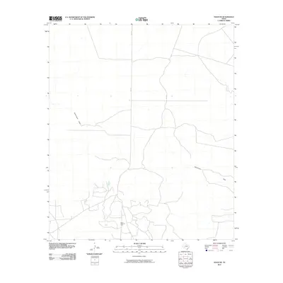
2010 Map of Texon SE
USGS Topo · Published 2010About this map
World Powell Oil Field anchors the southern portion of this landscape, representing the industrial character of the Permian Basin's energy production in the early 21st century. The terrain is defined by the ephemeral path of Schneemann Draw, which winds across the quadrangle and provides a primary geographic reference for the region's drainage patterns. This map illustrates a transition in the local infrastructure, where traditional ranching geography meets modern logistical needs. Navigational access is provided by FM 1676, which serves as a vital corridor through the otherwise sparse, open country of Crockett County. The distribution of scattered structures and local roads reflects the specialized requirements of regional petroleum operations during this period.
Find a feature on this map
3 named features on this map. Tap any name to fly to it.
Don’t see what you’re looking for? This feature index may not catch every label — zoom into the map to look around manually.
Map Details
Editions of this 2010 Texon SE Map
This is the sole edition of this map. No revisions or reprints were ever made.
Other maps of this area

1920 · Big Lake
USGS Topo · 1:62,500

1922 · Big Lake
USGS Topo · 1:62,500

1928 · Rankin
USGS Topo · 1:125,000

1929 · Sheffield
USGS Topo · 1:125,000

1954 · Sonora
USGS Topo · 1:250,000

1954 · San Angelo
USGS Topo · 1:250,000

1958 · Sonora
USGS Topo · 1:250,000

1958 · San Angelo
USGS Topo · 1:250,000

1965 · San Angelo
USGS Topo · 1:250,000

1967 · Owens Creek NE
USGS Topo · 1:24,000