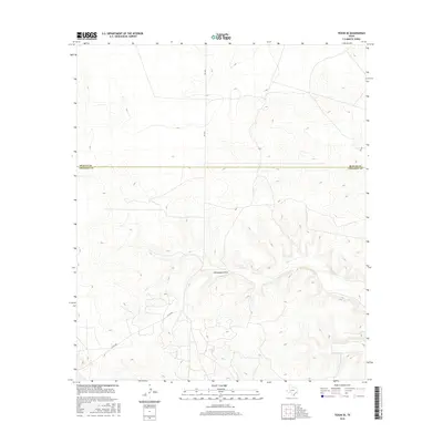
2016 Map of Texon SE
USGS Topo · Published 2016About this map
Schneemann Draw cuts through the high-elevation terrain of the Edwards Plateau in this West Texas survey. Situated along the jurisdictional boundary of Reagan Co and Crockett Co, the landscape is defined by its deep drainage patterns and remote cattle country character. The transportation network is sparse, consisting of a few vital conduits such as Fm 1676 and Co Rd 208 that navigate the ridges and valleys. This 2016 edition provides a clear picture of the modern ranching and oil-field infrastructure in a region where water sources like the draw are essential landmarks for navigation and land management. The contour intervals illustrate the significant vertical relief of the draws and mesas that characterize this portion of the Permian Basin's southern edge.
Find a feature on this map
5 named features on this map. Tap any name to fly to it.
Don’t see what you’re looking for? This feature index may not catch every label — zoom into the map to look around manually.
Map Details
Editions of this 2016 Texon SE Map
This is the sole edition of this map. No revisions or reprints were ever made.
Other maps of this area

1920 · Big Lake
USGS Topo · 1:62,500

1922 · Big Lake
USGS Topo · 1:62,500

1928 · Rankin
USGS Topo · 1:125,000

1929 · Sheffield
USGS Topo · 1:125,000

1954 · Sonora
USGS Topo · 1:250,000

1954 · San Angelo
USGS Topo · 1:250,000

1958 · Sonora
USGS Topo · 1:250,000

1958 · San Angelo
USGS Topo · 1:250,000

1965 · San Angelo
USGS Topo · 1:250,000

1967 · Owens Creek NE
USGS Topo · 1:24,000