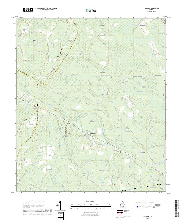
2024 Map of Thalmann
USGS Topo · Published 2024About this map
The low-lying wetlands of Glynn County are meticulously detailed here, centered on the settlement of Thalmann. This landscape is defined by an intricate network of water and hammocks, including Pepper Hammock and Red Oak Hammock, which rise above the surrounding Little Buffalo Swamp and Pumpkin Swamp. These island-like features served as natural anchor points for local life in a region where water determines the path of every road and rail line.
Find a feature on this map
77 named features on this map. Tap any name to fly to it.
Don’t see what you’re looking for? This feature index may not catch every label — zoom into the map to look around manually.
Map Details
Editions of this 2024 Thalmann Map
This is the sole edition of this map. No revisions or reprints were ever made.
Other maps of this area

1917 · Nahunta
USGS Topo · 1:62,500

1918 · Hortense
USGS Topo · 1:62,500

1918 · Everett City
USGS Topo · 1:62,500

1918 · Nahunta
USGS Topo · 1:62,500

1918 · Bladen
USGS Topo · 1:62,500

1920 · Everett City
USGS Topo · 1:62,500

1939 · Bladen
USGS Topo · 1:62,500

1944 · Everett City
USGS Topo · 1:62,500

1944 · Hortense
USGS Topo · 1:62,500

1946 · Brunswick
USGS Topo · 1:250,000