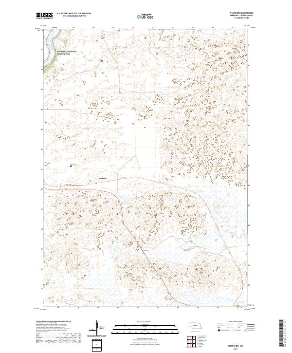
2021 Map of Thatcher
USGS Topo · Published 2021About this map
The Fort Niobrara National Wildlife Refuge dominates the northern landscape of this Cherry County region, preserving a critical intersection of river valley and prairie ecosystems. The Niobrara National Scenic River flows through the northwest corner, where the terrain shifts toward the canyon-carved banks of the Niobrara Wild and Scenic River. This area is defined by its transition from protected federal lands to the open ranching country of the Sandhills.
Find a feature on this map
13 named features on this map. Tap any name to fly to it.
Don’t see what you’re looking for? This feature index may not catch every label — zoom into the map to look around manually.
Map Details
Editions of this 2021 Thatcher Map
This is the sole edition of this map. No revisions or reprints were ever made.
Other maps of this area

1950 · Sparks
USGS Topo · 1:62,500

1950 · Simeon
USGS Topo · 1:62,500

1950 · Arabia
USGS Topo · 1:62,500

1950 · Valentine
USGS Topo · 1:62,500

1957 · Valentine
USGS Topo · 1:250,000

1959 · Valentine
USGS Topo · 1:250,000
1983 · Sparks
USGS Topo · 1:24,000
1983 · Valentine North
USGS Topo · 1:24,000

1983 · Valentine South
USGS Topo · 1:24,000
1983 · Thatcher
USGS Topo · 1:24,000