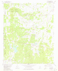
1980 Map of Thaxton
USGS Topo · Published 1981About this map
Thaxton and Toccopola anchor this topographic survey of the northeast Mississippi landscape at the turn of the 1980s. The region is defined by a dense network of country churches and small family-named watercourses, such as Buttermilk Branch and Duncans Creek. The eastern edge of the Holly Springs National Forest covers much of the northwestern quadrant, while localized industry is evident in the numerous Sandpits and a Claypit scattered near the settlements.
Find a feature on this map
36 named features on this map. Tap any name to fly to it.
Don’t see what you’re looking for? This feature index may not catch every label — zoom into the map to look around manually.
Map Details
Editions of this 1980 Thaxton Map
This is the sole edition of this map. No revisions or reprints were ever made.
Other maps of this area

1942 · Denmark
USGS Topo · 1:62,500

1943 · Denmark
USGS Topo · 1:62,500

1949 · New Albany
USGS Topo · 1:62,500

1951 · New Albany
USGS Topo · 1:62,500

1956 · Tupelo
USGS Topo · 1:250,000

1958 · Tupelo
USGS Topo · 1:250,000

1972 · Randolph
USGS Topo · 1:24,000
1972 · Southwest Pontotoc
USGS Topo · 1:24,000
1972 · Tula
USGS Topo · 1:24,000

1980 · Northwest Pontotoc
USGS Topo · 1:24,000