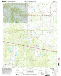
2000 Map of Thaxton
USGS Topo · Published 2003About this map
The Holly Springs National Forest anchors the northwestern corner of this landscape, marking a transition between protected woodland and the agricultural rhythms of Pontotoc and Lafayette counties. At the heart of the region lies the community of Thaxton, situated near the confluence of Duncans Branch and Buttermilk Branch. The map reveals a deeply rooted rural society defined by its local congregations and burial grounds, including Spring Hill Ch, Bluff Springs Ch, and the Laodicea Cem.
Find a feature on this map
27 named features on this map. Tap any name to fly to it.
Don’t see what you’re looking for? This feature index may not catch every label — zoom into the map to look around manually.
Map Details
Editions of this 2000 Thaxton Map
This is the sole edition of this map. No revisions or reprints were ever made.
Other maps of this area

1942 · Denmark
USGS Topo · 1:62,500

1943 · Denmark
USGS Topo · 1:62,500

1949 · New Albany
USGS Topo · 1:62,500

1951 · New Albany
USGS Topo · 1:62,500

1956 · Tupelo
USGS Topo · 1:250,000

1958 · Tupelo
USGS Topo · 1:250,000

1972 · Randolph
USGS Topo · 1:24,000
1972 · Southwest Pontotoc
USGS Topo · 1:24,000
1972 · Tula
USGS Topo · 1:24,000

1980 · Northwest Pontotoc
USGS Topo · 1:24,000