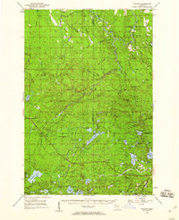
1952 Map of Thayer
USGS Topo · Published 1960About this map
The Ottawa National Forest dominates this mid-century portrait of Michigan's Upper Peninsula, where the landscape is defined by the dense network of the South Branch Ontonagon River and numerous glacial lakes. The Chicago and North Western railway cuts through the wilderness, serving small outposts like Gogebic Station, Thayer, and Beaton. These stops once served as vital links for the regional timber economy, connecting remote forest tracts to wider markets.
Find a feature on this map
78 named features on this map. Tap any name to fly to it.
Don’t see what you’re looking for? This feature index may not catch every label — zoom into the map to look around manually.
Map Details
Editions of this 1952 Thayer Map
4 editions found

Other maps of this area

1938 · Phelps
USGS Topo · 1:48,000

1939 · Trout Lake
USGS Topo · 1:48,000

1946 · Star Lake
USGS Topo · 1:48,000

1946 · Trout Lake
USGS Topo · 1:48,000

1949 · Trout Lake
USGS Topo · 1:48,000

1949 · Rockland
USGS Topo · 1:62,500

1950 · Phelps
USGS Topo · 1:48,000

1950 · Star Lake
USGS Topo · 1:48,000

1951 · Rockland
USGS Topo · 1:62,500

1952 · Watersmeet
USGS Topo · 1:62,500