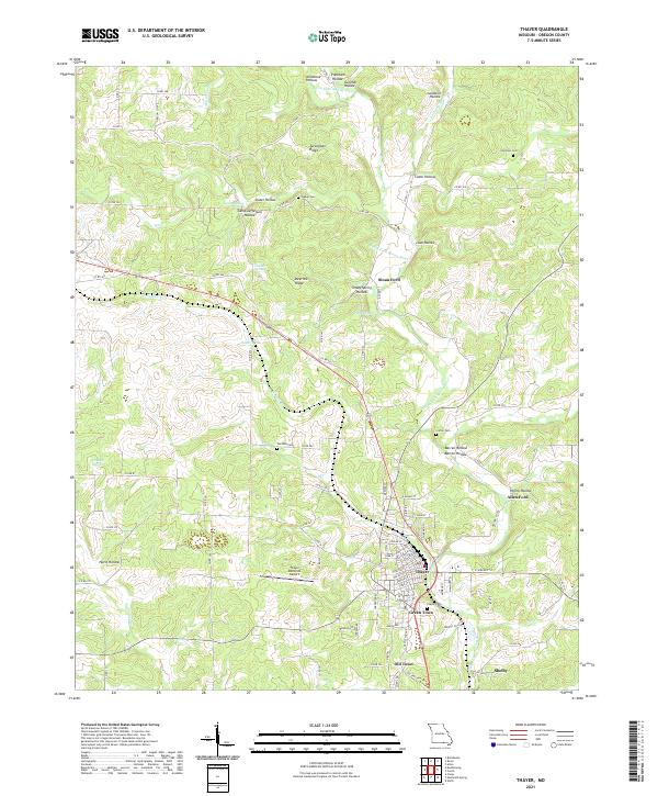
2021 Map of Thayer
USGS Topo · Published 2021About this map
Thayer serves as the focal point of this Ozark plateau landscape near the Arkansas border, where the terrain is deeply dissected by numerous hollows and springs. The town's layout is contrasted by the adjacent Green Town and Old Town, suggesting a historical progression of settlement along the regional transportation corridors. The Warm Fork Spring River and English Cr dictate much of the local topography, creating natural crossings like Sloan Ford and Allen Ford. Local history is preserved through several family and community burial grounds, including Childress Cem, Walker Cem, and Clifton Cem. The inclusion of the Thayer Memorial Airport and the small community of Shelby further illustrate the modern infrastructure integrated into this rural landscape, which is marked by distinctive features such as Turkeypen Ridge and Deerlick Ridge.
Find a feature on this map
96 named features on this map. Tap any name to fly to it.
Don’t see what you’re looking for? This feature index may not catch every label — zoom into the map to look around manually.
Map Details
Editions of this 2021 Thayer Map
This is the sole edition of this map. No revisions or reprints were ever made.
Other maps of this area

1943 · Thayer
USGS Topo · 1:62,500

1944 · Couch
USGS Topo · 1:62,500

1946 · Thayer
USGS Topo · 1:62,500

1946 · Couch
USGS Topo · 1:62,500

1957 · Poplar Bluff
USGS Topo · 1:250,000

1959 · Poplar Bluff
USGS Topo · 1:250,000

1960 · Poplar Bluff
USGS Topo · 1:250,000

1962 · Mammoth Spring
USGS Topo · 1:24,000
1962 · Camp
USGS Topo · 1:24,000
1968 · Wirth
USGS Topo · 1:24,000