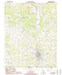
1986 Map of Thayer
USGS Topo · Published 1986About this map
The Warm Fork Spring River valley serves as the central corridor for this borderlands survey, where the town of Thayer sits at the nexus of the Missouri-Arkansas line. This mid-1980s data highlights the distinct neighborhoods of Old Town and Green Town, reflecting the historical growth and shifting residential patterns of the community. To the west, the Thayer Memorial Airport provides a modern landmark among the traditional farmland and ridge-and-hollow terrain.
Find a feature on this map
29 named features on this map. Tap any name to fly to it.
Don’t see what you’re looking for? This feature index may not catch every label — zoom into the map to look around manually.
Map Details
Editions of this 1986 Thayer Map
This is the sole edition of this map. No revisions or reprints were ever made.
Other maps of this area

1943 · Thayer
USGS Topo · 1:62,500

1944 · Couch
USGS Topo · 1:62,500

1946 · Thayer
USGS Topo · 1:62,500

1946 · Couch
USGS Topo · 1:62,500

1957 · Poplar Bluff
USGS Topo · 1:250,000

1959 · Poplar Bluff
USGS Topo · 1:250,000

1960 · Poplar Bluff
USGS Topo · 1:250,000

1962 · Mammoth Spring
USGS Topo · 1:24,000
1962 · Camp
USGS Topo · 1:24,000
1968 · Wirth
USGS Topo · 1:24,000