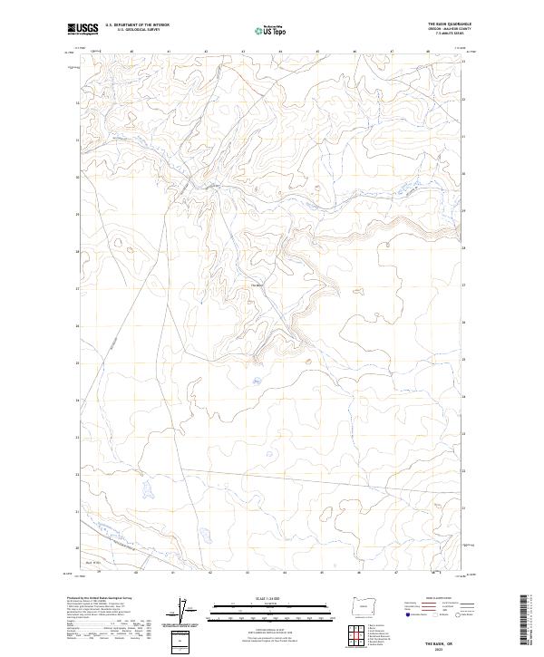
2023 Map of The Basin
USGS Topo · Published 2023About this map
The Basin defines the central geography of this remote portion of Malheur County, where the high desert landscape is etched by seasonal watercourses. The drainage patterns of Dry Creek in the north and Rattlesnake Creek in the south reveal a terrain shaped by erosion, with the Red Hills rising as a distinct landform in the southwestern corner. This area remains largely open range, crisscrossed by legacy routes such as the Old Ion Hwy and primitive access ways like Dry Creek Rd. The map illustrates the persistent structure of the Public Land Survey System, showing the complex township and range sections that have organized these expansive rangelands since the early days of settlement. The minimal development suggests a landscape dedicated to cattle ranching and resource management, where travel is dictated by the few established roads following the natural contours of the basin.
Find a feature on this map
16 named features on this map. Tap any name to fly to it.
Don’t see what you’re looking for? This feature index may not catch every label — zoom into the map to look around manually.
Map Details
Editions of this 2023 The Basin Map
This is the sole edition of this map. No revisions or reprints were ever made.
Other maps of this area

1955 · Jordan Valley
USGS Topo · 1:250,000

1957 · Jordan Valley
USGS Topo · 1:250,000

1958 · Jordan Valley
USGS Topo · 1:250,000

1972 · Rome
USGS Topo · 1:24,000
1972 · Scott Reservoir
USGS Topo · 1:24,000
1972 · Burns Junction
USGS Topo · 1:24,000

1979 · Rockhouse Reservoir
USGS Topo · 1:24,000

1979 · Bowden Ranch
USGS Topo · 1:24,000

1979 · Anderson Reservoir
USGS Topo · 1:24,000

1979 · Flat Top Mtn SE
USGS Topo · 1:24,000