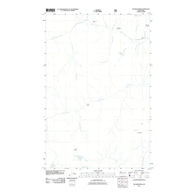
2011 Map of The Brothers
USGS Topo · Published 2011About this map
The Brothers peaks dominate this high-elevation landscape in the Olympic Peninsula, where a complex network of glacial meltwater feeds the Dosewallips River and the Duckabush River. This 2011 survey documents a wilderness marked by significant vertical relief, from the depths of Bull Elk Canyon to the summit of Mount Lena. Human presence is largely defined by primitive infrastructure and back-country access points, including the Dosewallips Campground and remote outposts like Dose Forks Camp and Tenmile Camp.
Find a feature on this map
29 named features on this map. Tap any name to fly to it.
Don’t see what you’re looking for? This feature index may not catch every label — zoom into the map to look around manually.
Map Details
Editions of this 2011 The Brothers Map
This is the sole edition of this map. No revisions or reprints were ever made.
Other maps of this area

1938 · Mt Constance
USGS Topo · 1:125,000

1944 · Mt. Angeles
USGS Topo · 1:62,500

1946 · Mt. Angeles
USGS Topo · 1:62,500

1946 · Tyler Peak
USGS Topo · 1:62,500

1947 · The Brothers
USGS Topo · 1:62,500

1947 · Mt. Steel
USGS Topo · 1:62,500

1948 · Tyler Peak
USGS Topo · 1:62,500

1950 · The Brothers
USGS Topo · 1:62,500

1950 · Mt. Steel
USGS Topo · 1:62,500

1958 · Seattle
USGS Topo · 1:250,000