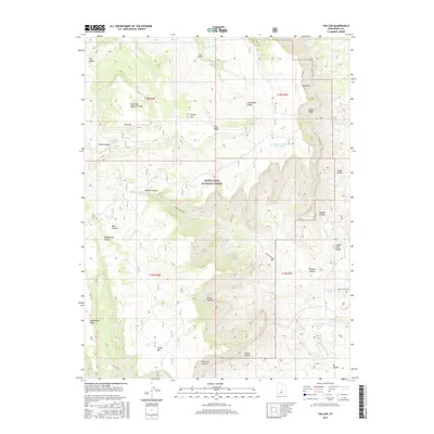
2017 Map of The Cap
USGS Topo · Published 2017About this map
Manti-La Sal National Forest encompasses much of this high-elevation landscape in Emery County, characterized by a complex network of swales, canyons, and plateaus. Significant topographical landmarks like N Horn Mtn and S Horn Mtn anchor the terrain, while drainage systems such as Rock Canyon Cr and Daniels Canyon have carved deep incisions through the earth. The management of water in this arid environment is evident through several small impoundments and catchments, including Baseball Pond, the Long Point Number 3 Reservoir, and W Clawson Reservoir. Names like Reid and Nielson Swale and Jewkes Hollow suggest the area's history of grazing and ranching. Access is primarily limited to rugged routes like Rock Canyon Rd, which traverses the eastern slopes near the Indian Trail Bench.
Find a feature on this map
36 named features on this map. Tap any name to fly to it.
Don’t see what you’re looking for? This feature index may not catch every label — zoom into the map to look around manually.
Map Details
Editions of this 2017 The Cap Map
This is the sole edition of this map. No revisions or reprints were ever made.
Other maps of this area

1885 · Manti
USGS Topo · 1:250,000

1895 · Manti
USGS Topo · 1:250,000

1922 · Wasatch
USGS Topo · 1:31,680

1923 · Castle Dale
USGS Topo · 1:62,500

1923 · Hiawatha
USGS Topo · 1:62,500

1925 · Castle Dale
USGS Topo · 1:62,500

1925 · Hiawatha
USGS Topo · 1:62,500

1956 · Price
USGS Topo · 1:250,000

1960 · Price
USGS Topo · 1:250,000

1962 · Price
USGS Topo · 1:250,000