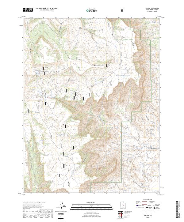
2023 Map of The Cap
USGS Topo · Published 2023About this map
Manti-La Sal National Forest defines the rugged high-elevation landscape of this 2023 survey in Emery County. The topography is dominated by massive flat-topped formations, most notably North Horn Mtn and South Horn Mtn, separated by the deep incision of Rock Canyon Creek. The high plateau contains specialized water features like Baseball Pond and Baseball Spring, which reflect the area's history of high-country grazing and resource management. To the east, the terrain drops significantly toward West Clawson Reservoir, revealing a complex system of drainage channels including Killpack Canyon and Jewkes Hollow. This modern data shows the persistent importance of water infrastructure in the arid West, seen in the Long Point Number 3 Reservoir and the network of named swales like Clay Banks Swale that direct seasonal runoff through the canyon systems.
Find a feature on this map
30 named features on this map. Tap any name to fly to it.
Don’t see what you’re looking for? This feature index may not catch every label — zoom into the map to look around manually.
Map Details
Editions of this 2023 The Cap Map
This is the sole edition of this map. No revisions or reprints were ever made.
Other maps of this area

1885 · Manti
USGS Topo · 1:250,000

1895 · Manti
USGS Topo · 1:250,000

1922 · Wasatch
USGS Topo · 1:31,680

1923 · Castle Dale
USGS Topo · 1:62,500

1923 · Hiawatha
USGS Topo · 1:62,500

1925 · Castle Dale
USGS Topo · 1:62,500

1925 · Hiawatha
USGS Topo · 1:62,500

1956 · Price
USGS Topo · 1:250,000

1960 · Price
USGS Topo · 1:250,000

1962 · Price
USGS Topo · 1:250,000