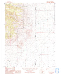
1986 Map of The Cove
USGS Topo · Published 1993About this map
Humboldt National Forest defines the western edge of this Nevada landscape, where the high terrain of the Snake Range drops toward the Utah border. This 1980s survey captures a transition between the elevated wilderness of Red Ledge Canyon and Old Mans Canyon and the arid flats to the east. Extensive mapping of extractive activity is visible throughout the slopes, with numerous Quarries and Prospects scattered along the drainages of Hampton Creek and Hendrys Creek. This concentration of survey points suggests a period of active geological exploration or mineral assessment in the region. Near the center of the map, the namesake feature The Cove sits below the ridgeline, while Caine Spring provides a rare water source in the lower elevations near the county line.
Find a feature on this map
18 named features on this map. Tap any name to fly to it.
Don’t see what you’re looking for? This feature index may not catch every label — zoom into the map to look around manually.
Map Details
Editions of this 1986 The Cove Map
2 editions found
Other maps of this area

1908 · Fish Springs
USGS Topo · 1:250,000

1910 · Fish Springs
USGS Topo · 1:250,000

1953 · Delta
USGS Topo · 1:250,000

1956 · Ely
USGS Topo · 1:250,000

1958 · Delta
USGS Topo · 1:250,000

1959 · Ely
USGS Topo · 1:250,000

1960 · Conger Range
USGS Topo · 1:62,500

1960 · Gandy
USGS Topo · 1:62,500

1962 · Delta
USGS Topo · 1:250,000

1963 · Ely
USGS Topo · 1:250,000