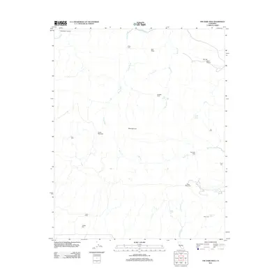
2012 Map of The Dark Hole
USGS Topo · Published 2012About this map
Picacho Rock and Castle Mountain anchor this landscape in Fresno County, where the topography is defined by the sharp elevations of Reef Ridge and the eponymous The Dark Hole. The map reveals a pattern of dispersed, isolated outposts including Moore Cabin, Riley Cabin, and Yost Cabin, suggesting a history of seasonal ranching or remote resource management. Water is a critical but sparse element, drawn from sources like Cold Spring, Number Seven Spring, and Sugar Tail Spring. This region, characterized by its varied terrain from Oak Flat to the deep contours of Reese Canyon, remains largely undeveloped, preserving the original footprints of the Taylor Ranch and several family-named cabins that speak to the area's rural heritage.
Find a feature on this map
28 named features on this map. Tap any name to fly to it.
Don’t see what you’re looking for? This feature index may not catch every label — zoom into the map to look around manually.
Map Details
Editions of this 2012 The Dark Hole Map
This is the sole edition of this map. No revisions or reprints were ever made.
Other maps of this area

1912 · Coalinga
USGS Topo · 1:125,000

1914 · Cholame
USGS Topo · 1:125,000

1915 · Cholame
USGS Topo · 1:125,000

1917 · Cholame
USGS Topo · 1:125,000

1930 · Canoas Creek
USGS Topo · 1:31,680

1934 · The Dark Hole
USGS Topo · 1:31,680

1934 · Reef Ridge
USGS Topo · 1:31,680

1934 · Canoas Creek
USGS Topo · 1:31,680

1936 · Kreyenhagen Hills
USGS Topo · 1:31,680
1937 · Reef Ridge
USGS Topo · 1:31,680