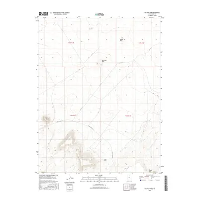
2017 Map of The Flat Tops
USGS Topo · Published 2017About this map
The San Rafael Desert dominates this terrain in Emery County, characterized by a series of prominent mesas and volcanic features. Large geological formations like The Big Flat Tops and The Flat Tops define the southern portion of the quadrangle, where the land rises sharply toward high plateaus. These isolated elevations are complemented by distinct landmarks such as Spire Point, Rattlesnake Butte, and Wildcat Butte, which serve as natural navigation points across the arid landscape.
Find a feature on this map
19 named features on this map. Tap any name to fly to it.
Don’t see what you’re looking for? This feature index may not catch every label — zoom into the map to look around manually.
Map Details
Editions of this 2017 The Flat Tops Map
This is the sole edition of this map. No revisions or reprints were ever made.
Other maps of this area

1885 · San Rafael
USGS Topo · 1:250,000

1953 · Tidwell 3 NW
USGS Topo · 1:24,000

1953 · Temple Mtn
USGS Topo · 1:62,500

1954 · Stinking Spring Creek 4 NE
USGS Topo · 1:24,000

1954 · Stinking Spring Creek 4 SE
USGS Topo · 1:24,000

1956 · Salina
USGS Topo · 1:250,000

1960 · Salina
USGS Topo · 1:250,000

1962 · Salina
USGS Topo · 1:250,000

1963 · Robbers Roost Canyon
USGS Topo · 1:62,500
1963 · Hanksville
USGS Topo · 1:62,500