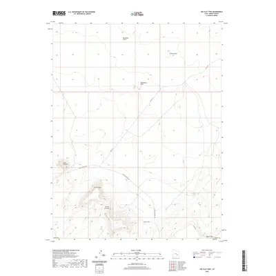
2020 Map of The Flat Tops
USGS Topo · Published 2020About this map
The Flat Tops rise as prominent geological features above the surrounding San Rafael Desert in this portion of Emery County. The landscape is defined by its distinct landforms, including The Big Flat Tops and the isolated Little Flat Top to the west. These mesas and buttes serve as primary navigational landmarks across an arid terrain where water sources are scarce, marked primarily by Sweetwater Spring and the drainage of Dugout Wash.
Find a feature on this map
14 named features on this map. Tap any name to fly to it.
Don’t see what you’re looking for? This feature index may not catch every label — zoom into the map to look around manually.
Map Details
Editions of this 2020 The Flat Tops Map
This is the sole edition of this map. No revisions or reprints were ever made.
Other maps of this area

1885 · San Rafael
USGS Topo · 1:250,000

1953 · Tidwell 3 NW
USGS Topo · 1:24,000

1953 · Temple Mtn
USGS Topo · 1:62,500

1954 · Stinking Spring Creek 4 NE
USGS Topo · 1:24,000

1954 · Stinking Spring Creek 4 SE
USGS Topo · 1:24,000

1956 · Salina
USGS Topo · 1:250,000

1960 · Salina
USGS Topo · 1:250,000

1962 · Salina
USGS Topo · 1:250,000

1963 · Robbers Roost Canyon
USGS Topo · 1:62,500
1963 · Hanksville
USGS Topo · 1:62,500