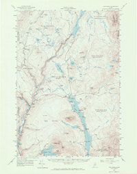
1956 Map of The Forks
USGS Topo · Published 1970About this map
The confluence of the Kennebec River and the Dead River anchors this mid-century portrait of Somerset County. Settled within the deep valleys of The Forks, the landscape is defined by the heavy infrastructure of the timber and power industries. The massive Harris Dam regulates the river's flow, while a network of woods roads, including the Tote Road, connects remote timber stands to the water. Local life is documented at the Franklin Sch and Ball Sch, providing essential coordinates for genealogists tracing families in the townships of West Forks and Caratunk.
Find a feature on this map
94 named features on this map. Tap any name to fly to it.
Don’t see what you’re looking for? This feature index may not catch every label — zoom into the map to look around manually.
Map Details
Editions of this 1956 The Forks Map
5 editions found

Other maps of this area

1903 · Bingham
USGS Topo · 1:62,500

1905 · Bingham
USGS Topo · 1:62,500

1905 · The Forks
USGS Topo · 1:62,500

1907 · The Forks
USGS Topo · 1:62,500

1920 · Moosehead Lake
USGS Topo · 1:62,500

1921 · Brassua Lake
USGS Topo · 1:62,500

1922 · Moosehead Lake
USGS Topo · 1:62,500

1922 · Long Pond
USGS Topo · 1:62,500

1923 · Brassua Lake
USGS Topo · 1:62,500

1924 · Long Pond
USGS Topo · 1:62,500