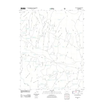
2011 Map of The Glade
USGS Topo · Published 2011About this map
The Glade defines this portion of Dolores County, where a complex network of man-made water catchments and natural springs supports a high-desert landscape. The area is marked by a distinctive system of numbered reservoirs, such as Big Water Reservoir Number Six and Wild Bill Number Two Reservoir, reflecting a highly managed approach to water security in this arid region. These features, along with numerous springs like Wolf Den Spring and Rock Spring, highlight the essential infrastructure required for ranching or resource management.
Find a feature on this map
83 named features on this map. Tap any name to fly to it.
Don’t see what you’re looking for? This feature index may not catch every label — zoom into the map to look around manually.
Map Details
Editions of this 2011 The Glade Map
This is the sole edition of this map. No revisions or reprints were ever made.
Other maps of this area

1949 · Joe Davis Hill
USGS Topo · 1:24,000

1950 · Joe Davis Hill
USGS Topo · 1:24,000

1956 · Cortez
USGS Topo · 1:250,000

1958 · Cortez
USGS Topo · 1:250,000

1959 · Cortez
USGS Topo · 1:250,000

1962 · Cortez
USGS Topo · 1:250,000
1964 · Dawson Draw
USGS Topo · 1:24,000

1964 · Glade Mountain
USGS Topo · 1:24,000

1964 · Mc Kenna Peak
USGS Topo · 1:24,000
1964 · Secret Canyon
USGS Topo · 1:24,000