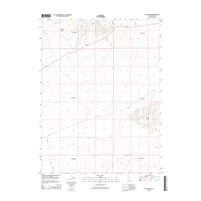
2014 Map of The Hogback
USGS Topo · Published 2014About this map
Keg Mtn and the prominent ridge known as The Hogback define the arid landscape of this Juab County region. The terrain is crisscrossed by a network of specialized roads and paths, including Keg Mining Rd, Wilson Camp Rd, and Keg Camp Rd, reflecting a history of mineral exploration and remote backcountry access. A designated Rock Hounding Area in the northern portion of the quadrangle highlights the geological interest of the area, while the presence of Hogback Reservoir and the Crater Bench show the sparse but critical water management and volcanic features of the Great Basin. This 2014 survey captures the area's transition into a recreational and geological destination while maintaining its traditional mining and ranching infrastructure along the Weiss Hwy.
Find a feature on this map
19 named features on this map. Tap any name to fly to it.
Don’t see what you’re looking for? This feature index may not catch every label — zoom into the map to look around manually.
Map Details
Editions of this 2014 The Hogback Map
This is the sole edition of this map. No revisions or reprints were ever made.
Other maps of this area

1885 · Sevier Desert
USGS Topo · 1:250,000

1953 · Delta
USGS Topo · 1:250,000

1958 · Delta
USGS Topo · 1:250,000

1962 · Delta
USGS Topo · 1:250,000

1971 · Baker Hot Springs
USGS Topo · 1:24,000

1971 · Picture Rock Hills
USGS Topo · 1:24,000

1971 · Drum Mts Well
USGS Topo · 1:24,000

1971 · Crater Bench Reservoir
USGS Topo · 1:24,000
1971 · Keg Mtn Ranch
USGS Topo · 1:24,000

1971 · Fumarole Butte
USGS Topo · 1:24,000