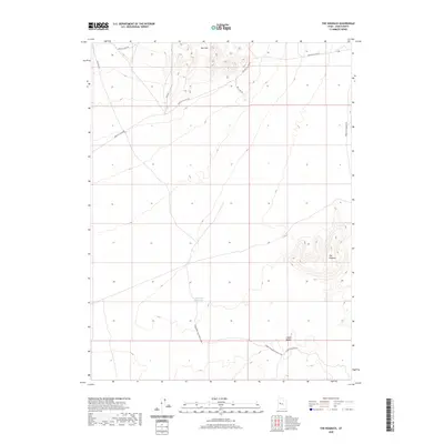
2020 Map of The Hogback
USGS Topo · Published 2020About this map
Keg Mtn dominates the northern reaches of this high-desert landscape in Juab County, where the topography shifts from steep ridgelines to the broad expanses of Crater Bench. The map illustrates a network of essential desert transit routes that converge near The Hogback, a prominent geological spine. These roads, including the Jericho Callao Rd and the Baker Hot Springs Rd, provide access through this arid terrain, linking remote camps and water sources. Hogback Reservoir serves as a critical hydrologic point in the lower elevations, reflecting the sparse but vital water management infrastructure necessary for land use in this part of the West. The intricate contouring reveals a complex system of washes and drainage patterns, such as the Baker Hogs Back Right Fork, which define the movement of water across the open range.
Find a feature on this map
12 named features on this map. Tap any name to fly to it.
Don’t see what you’re looking for? This feature index may not catch every label — zoom into the map to look around manually.
Map Details
Editions of this 2020 The Hogback Map
This is the sole edition of this map. No revisions or reprints were ever made.
Other maps of this area

1885 · Sevier Desert
USGS Topo · 1:250,000

1953 · Delta
USGS Topo · 1:250,000

1958 · Delta
USGS Topo · 1:250,000

1962 · Delta
USGS Topo · 1:250,000

1971 · Baker Hot Springs
USGS Topo · 1:24,000

1971 · Picture Rock Hills
USGS Topo · 1:24,000

1971 · Drum Mts Well
USGS Topo · 1:24,000

1971 · Crater Bench Reservoir
USGS Topo · 1:24,000
1971 · Keg Mtn Ranch
USGS Topo · 1:24,000

1971 · Fumarole Butte
USGS Topo · 1:24,000