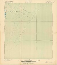
1919 Map of The Jetties
USGS Topo · Published 1919About this map
Morris Island and its northern tip at Cummings Point define the coastal landscape of this 1918 compilation. The map focuses on the hydraulic engineering of the harbor entrance, specifically the diverging paths of the North Jetty and South Jetty as they extend into the Atlantic Ocean. These massive stone structures, managed by the Corps of Engineers, were critical for maintaining the shipping channel. The survey provides a clear view of the bathymetry and shifting shoals surrounding these artificial landmarks, which were essential for navigation near Fort Moultrie during the early twentieth century. Because the map was produced in cooperation with the War Department, it emphasizes the maritime infrastructure and underwater contours that shaped the approach to the historic harbor.
Find a feature on this map
5 named features on this map. Tap any name to fly to it.
Don’t see what you’re looking for? This feature index may not catch every label — zoom into the map to look around manually.
Map Details
Editions of this 1919 The Jetties Map
4 editions found
Other maps of this area

1919 · The Jetties
USGS Topo · 1:21,120

1919 · Capers Island
USGS Topo · 1:21,120

1919 · Charleston
USGS Topo · 1:21,120

1919 · James Island
USGS Topo · 1:21,120

1919 · Fort Moultrie
USGS Topo · 1:21,120

1943 · Capers Island
USGS Topo · 1:24,000

1943 · Fort Moultrie
USGS Topo · 1:24,000

1943 · James Island
USGS Topo · 1:24,000

1948 · James Island
USGS Topo · 1:250,000
1948 · Charleston
USGS Topo · 1:24,000