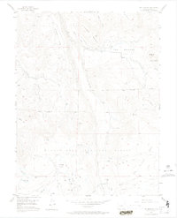
1955 Map of The Meadows
USGS Topo · Published 1974About this map
The high plateau country of the Grand Mesa National Forest is defined here by a network of cattle-country landmarks and remote water sources. In the mid-1950s, this landscape supported seasonal ranching activities, evidenced by the Leon Cow Camp and several family-named water features like Anderson Bros Res and Mc Kelvie Res. The terrain transitions from the broad expanses of Kirkendall Flats and Sheep Flats toward the more prominent heights of Campbell Mountain and Bogue Mountain. This era was one of essential, functional infrastructure for the high country, with long drift fences and simple paths like Spruce Trail and Silver Trail facilitating movement through the timber and across the meadows. Numerous Beaver Ponds are mapped along drainage ways like Park Creek and Leon Creek, indicating the natural drainage patterns that sustain this elevated ecosystem.
Find a feature on this map
45 named features on this map. Tap any name to fly to it.
Don’t see what you’re looking for? This feature index may not catch every label — zoom into the map to look around manually.
Map Details
Editions of this 1955 The Meadows Map
8 editions found
Other maps of this area

1955 · Collbran
USGS Topo · 1:24,000

1955 · Grand Mesa
USGS Topo · 1:24,000

1955 · The Meadows
USGS Topo · 1:24,000

1957 · Leadville
USGS Topo · 1:250,000

1959 · Leadville
USGS Topo · 1:250,000

1960 · Leadville
USGS Topo · 1:250,000

1960 · Leon Peak
USGS Topo · 1:24,000
1960 · Hawxhurst Creek
USGS Topo · 1:24,000

1960 · South Mamm Peak
USGS Topo · 1:24,000

1961 · Porter Mountain
USGS Topo · 1:24,000