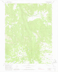
1955 Map of The Meadows
USGS Topo · Published 1981About this map
The Meadows serves as a high-altitude drainage basin for a complex network of alpine streams, including Salt Creek, Leon Creek, and Plateau Creek. This 1955 survey illustrates the land-use patterns within the Grand Mesa National Forest, where the landscape is defined by vast plateaus and specialized cattle grazing infrastructure like the Leon Cow Camp. The presence of several family-named landmarks such as Kirkendall Flats and Bogue Mountain points to the early homesteading and ranching history that preceded the forest's federal management. Water management is a primary feature of the terrain, evidenced by numerous Beaver Ponds and man-made structures like Labbie Res and Anderson Res. The map also captures the early transportation routes of the area, featuring the Salt Creek Road and specialized paths like the Spruce Trail and High Trail winding through The Flat Tops.
Find a feature on this map
43 named features on this map. Tap any name to fly to it.
Don’t see what you’re looking for? This feature index may not catch every label — zoom into the map to look around manually.
Map Details
Editions of this 1955 The Meadows Map
8 editions found
Other maps of this area

1955 · Collbran
USGS Topo · 1:24,000

1955 · Grand Mesa
USGS Topo · 1:24,000

1955 · The Meadows
USGS Topo · 1:24,000

1957 · Leadville
USGS Topo · 1:250,000

1959 · Leadville
USGS Topo · 1:250,000

1960 · Leadville
USGS Topo · 1:250,000

1960 · Leon Peak
USGS Topo · 1:24,000
1960 · Hawxhurst Creek
USGS Topo · 1:24,000

1960 · South Mamm Peak
USGS Topo · 1:24,000

1961 · Porter Mountain
USGS Topo · 1:24,000