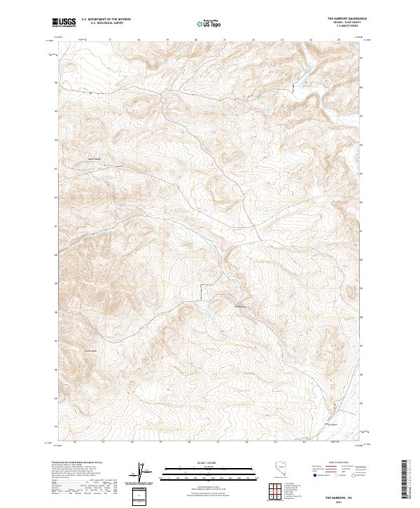
2021 Map of The Narrows
USGS Topo · Published 2021About this map
Adobe Range defines the high elevation of this Elko County landscape, where various seasonal water sources emerge across the arid terrain. The map details the central formation known as The Narrows, a critical geographic waypoint where Twin Springs Cr cuts through the high ground. The hydrology of the region is anchored by the N Fork Humboldt River in the northeast, while numerous isolated water points such as McKnight Springs, Wildcat Spring, and Twin Springs indicate the vital importance of spring-fed resources in this high desert environment.
Find a feature on this map
19 named features on this map. Tap any name to fly to it.
Don’t see what you’re looking for? This feature index may not catch every label — zoom into the map to look around manually.
Map Details
Editions of this 2021 The Narrows Map
This is the sole edition of this map. No revisions or reprints were ever made.
Other maps of this area

1955 · Wells
USGS Topo · 1:250,000

1958 · Wells
USGS Topo · 1:250,000

1961 · Wells
USGS Topo · 1:250,000

1967 · Hanks Creek SW
USGS Topo · 1:24,000

1967 · Peko Peak
USGS Topo · 1:24,000
1967 · Morgan Hill
USGS Topo · 1:24,000
1971 · Coal Mine Basin
USGS Topo · 1:24,000
1971 · The Buttes
USGS Topo · 1:24,000

1971 · Double Mtn SE
USGS Topo · 1:24,000
1971 · Coal Mine Canyon SE
USGS Topo · 1:24,000