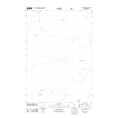
2011 Map of The Needles
USGS Topo · Published 2011About this map
Boulder Mountain and the distinctive geological formation known as The Needles define this high-elevation portion of Park County. This 2011 survey illustrates a landscape dominated by the drainage systems of the Boulder River and East Fork Mill Creek, which are fed by numerous seasonal and perennial tributaries such as Meattrack Creek and Tuscarora Creek. High-altitude water bodies like Silver Lake and Bridge Lake sit tucked below prominent summits including Carbonate Mountain and War Eagle Mountain. The absence of roads and the presence of named alpine crossings like Silver Pass emphasize the remote, primitive character of the terrain. For researchers and geographers, the map provides a precise look at the hydrology of the northern Rockies, tracing how water moves from snow-fed peaks into named branches like Marie Creek and Snowslide Creek.
Find a feature on this map
20 named features on this map. Tap any name to fly to it.
Don’t see what you’re looking for? This feature index may not catch every label — zoom into the map to look around manually.
Map Details
Editions of this 2011 The Needles Map
This is the sole edition of this map. No revisions or reprints were ever made.
Other maps of this area

1891 · Livingston
USGS Topo · 1:250,000

1893 · Livingston
USGS Topo · 1:250,000

1940 · Mt. Cowen
USGS Topo · 1:62,500

1940 · Mt Wallace
USGS Topo · 1:62,500

1941 · Mt Douglas
USGS Topo · 1:62,500

1942 · Cutoff Mtn
USGS Topo · 1:62,500

1943 · Mt Wallace
USGS Topo · 1:62,500

1943 · Mt Douglas
USGS Topo · 1:62,500

1943 · Mt Cowen
USGS Topo · 1:62,500

1944 · Cutoff Mtn
USGS Topo · 1:62,500