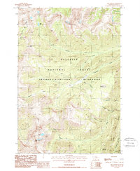
1987 Map of The Needles
USGS Topo · Published 1988About this map
The high elevations of Gallatin National Forest and the Absaroka-Beartooth Wilderness dominate this high-country landscape in the late 1980s. Defined by significant topographic relief, the area is accessible primarily through primitive routes like the Fourmile Pack Trail and the Meattrack Trail, which navigate the steep drainages of Fourmile Creek and Meattrack Creek. The absence of roads underscores the preserved character of this mountain environment, where prominent peaks such as Crow Mountain and War Eagle Mountain tower over alpine waters like Silber Lake and Bridge Lake.
Find a feature on this map
26 named features on this map. Tap any name to fly to it.
Don’t see what you’re looking for? This feature index may not catch every label — zoom into the map to look around manually.
Map Details
Editions of this 1987 The Needles Map
This is the sole edition of this map. No revisions or reprints were ever made.
Other maps of this area

1891 · Livingston
USGS Topo · 1:250,000

1893 · Livingston
USGS Topo · 1:250,000

1940 · Mt. Cowen
USGS Topo · 1:62,500

1940 · Mt Wallace
USGS Topo · 1:62,500

1941 · Mt Douglas
USGS Topo · 1:62,500

1942 · Cutoff Mtn
USGS Topo · 1:62,500

1943 · Mt Wallace
USGS Topo · 1:62,500

1943 · Mt Douglas
USGS Topo · 1:62,500

1943 · Mt Cowen
USGS Topo · 1:62,500

1944 · Cutoff Mtn
USGS Topo · 1:62,500