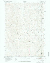
1953 Map of The Nipple
USGS Topo · Published 1976About this map
Pumpkin Creek and Willow Creek thread through this high plains landscape along the border of Johnson and Campbell Counties during the early 1950s. The United States Atomic Energy Commission participated in this survey, reflecting the era's interest in western mineral resources. The terrain is marked by seasonal drainages like Windmill Draw and Craney Draw, alongside scattered water sources essential for livestock, such as School Section Spring and an Artesian Well. The settlement pattern shows a shift in land use, with both Dobrenz Ranch (Aband) and Wilson Ranch (Aband) noted as abandoned at the time of the field check. Distinctive elevations including The Nipple and triangulation stations like VABM 4966 Cooper serve as primary landmarks in this sparsely populated territory.
Find a feature on this map
19 named features on this map. Tap any name to fly to it.
Don’t see what you’re looking for? This feature index may not catch every label — zoom into the map to look around manually.
Map Details
Editions of this 1953 The Nipple Map
2 editions found
Other maps of this area

1953 · Hoe Ranch
USGS Topo · 1:24,000

1953 · Fort Reno
USGS Topo · 1:24,000

1953 · Fort Reno SE
USGS Topo · 1:24,000

1953 · Fats Draw
USGS Topo · 1:24,000

1953 · The Nipple
USGS Topo · 1:24,000

1953 · North Butte
USGS Topo · 1:24,000

1954 · Gillette
USGS Topo · 1:250,000

1955 · Newcastle
USGS Topo · 1:250,000

1955 · Sheridan
USGS Topo · 1:250,000

1955 · Arminto
USGS Topo · 1:250,000