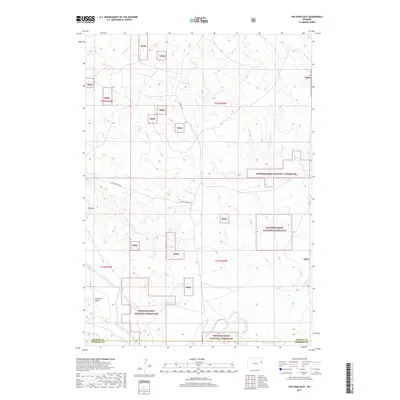
2017 Map of The Nose East
USGS Topo · Published 2017About this map
Thunder Basin National Grassland dominates this high plains landscape on the border of Weston and Niobrara counties. The terrain is defined by a network of drainage systems, including Lodgepole Cr, Wildcat Cr, and Coyote Cr, which feed into the prominent Cheyenne River as it winds through the southern portion of the quadrangle. High points and landform features like The Nose and Graham Draw provide topographic orientation across the vast range. Settlement is sparse in this part of Wyoming, with the land utility marked by rural routes such as Cheyenne River Rd and Grieves Rd. The map illustrates a preserved section of the American West, highlighting the complex relationship between federal land management and the natural watercourses that sustain the prairie ecosystem.
Find a feature on this map
15 named features on this map. Tap any name to fly to it.
Don’t see what you’re looking for? This feature index may not catch every label — zoom into the map to look around manually.
Map Details
Editions of this 2017 The Nose East Map
This is the sole edition of this map. No revisions or reprints were ever made.
Other maps of this area

1899 · Newcastle
USGS Topo · 1:125,000

1901 · Newcastle
USGS Topo · 1:125,000

1955 · Newcastle
USGS Topo · 1:250,000

1958 · Newcastle
USGS Topo · 1:250,000

1979 · Newcastle
USGS Topo · 1:100,000

1981 · Horseshoe Bend
USGS Topo · 1:24,000

1981 · Threemile Butte
USGS Topo · 1:24,000

1981 · Garland Draw
USGS Topo · 1:24,000

1981 · Lance Creek
USGS Topo · 1:100,000
1982 · Morrisey
USGS Topo · 1:24,000