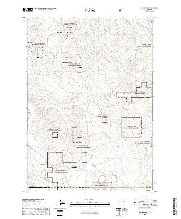
2021 Map of The Nose East
USGS Topo · Published 2021About this map
Thunder Basin National Grassland dominates this high-plains landscape, where the public land is interspersed with private holdings across the border of Weston and Niobrara counties. The drainage network is the defining characteristic of this terrain, with the Cheyenne River carving a path through the southern sections. Tributaries such as Lodgepole Cr, Wildcat Cr, and Coyote Cr create a complex system of draws and breaks, including the distinctive landmark known as The Nose. Ranching and resource management are evident in the presence of Butte Reservoir and local transport routes like Cheyenne River Rd and Grieves Rd. This survey provides a modern view of the open range before more recent developments might alter these established land-use patterns, highlighting the persistent importance of water sources in the Wyoming grasslands.
Find a feature on this map
15 named features on this map. Tap any name to fly to it.
Don’t see what you’re looking for? This feature index may not catch every label — zoom into the map to look around manually.
Map Details
Editions of this 2021 The Nose East Map
This is the sole edition of this map. No revisions or reprints were ever made.
Other maps of this area

1899 · Newcastle
USGS Topo · 1:125,000

1901 · Newcastle
USGS Topo · 1:125,000

1955 · Newcastle
USGS Topo · 1:250,000

1958 · Newcastle
USGS Topo · 1:250,000

1979 · Newcastle
USGS Topo · 1:100,000

1981 · Horseshoe Bend
USGS Topo · 1:24,000

1981 · Threemile Butte
USGS Topo · 1:24,000

1981 · Garland Draw
USGS Topo · 1:24,000

1981 · Lance Creek
USGS Topo · 1:100,000
1982 · Morrisey
USGS Topo · 1:24,000