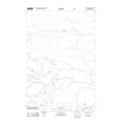
2012 Map of The Notch
USGS Topo · Published 2012About this map
The Notch and the high ridges of Crook County define this 2012 survey, where the drainages of the Bearlodge Mountains break into complex basin and range topography. The landscape is characterized by a series of high-altitude water sources and cattle-country infrastructure, including Geis Reservoir and numerous named springs such as Pearson Spring and Mitchell Spring. These reliable water points have historically supported ranching and forest operations across Oak Creek Basin and along the slopes of Carlson Ridge. Forest service roads and trails like Bearlodge Br 4e provide access to the interior of this high country, which remains a focal point for recreation and land management. The presence of the Bear Lodge Campground near the confluence of local tributaries suggests the area's continued importance as a gateway for those navigating the transition between Basin Draw and the more prominent peaks like Little Table Mountain.
Find a feature on this map
44 named features on this map. Tap any name to fly to it.
Don’t see what you’re looking for? This feature index may not catch every label — zoom into the map to look around manually.
Map Details
Editions of this 2012 The Notch Map
This is the sole edition of this map. No revisions or reprints were ever made.
Other maps of this area

1901 · Aladdin
USGS Topo · 1:125,000

1903 · Aladdin
USGS Topo · 1:125,000

1954 · Gillette
USGS Topo · 1:250,000

1955 · Gillette
USGS Topo · 1:250,000

1957 · Mona
USGS Topo · 1:62,500

1957 · Colony
USGS Topo · 1:62,500

1958 · Gillette
USGS Topo · 1:250,000

1958 · Beulah
USGS Topo · 1:62,500

1962 · Gillette
USGS Topo · 1:250,000
1979 · Devils Tower
USGS Topo · 1:100,000