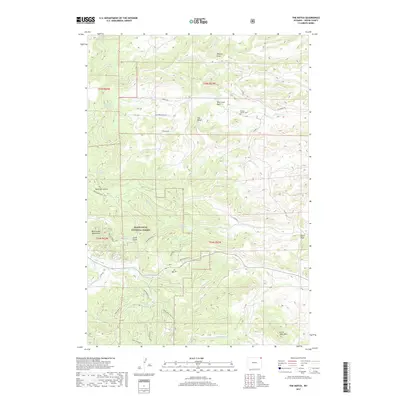
2017 Map of The Notch
USGS Topo · Published 2017About this map
Black Hills National Forest land dominates the landscape of Crook County, where the Bear Lodge Mountains rise alongside the distinctive gap of The Notch. This 2017 survey details a high-elevation environment defined by spring-fed drainages and a dense network of forest service roads. Genealogists and local historians can locate the Kimball Family Cem near Oak Creek Basin, providing a specific point of family history within the public lands. Water remains the primary shaper of the terrain here, from the headwaters of Alum Cr and Fawn Creek to the engineered Geis Reservoir. The map illustrates how late-20th-century resource management utilized routes like the Bear Lodge Truck Trl to navigate through features such as Lucky Gulch and across Little Table Mtn.
Find a feature on this map
52 named features on this map. Tap any name to fly to it.
Don’t see what you’re looking for? This feature index may not catch every label — zoom into the map to look around manually.
Map Details
Editions of this 2017 The Notch Map
This is the sole edition of this map. No revisions or reprints were ever made.
Other maps of this area

1901 · Aladdin
USGS Topo · 1:125,000

1903 · Aladdin
USGS Topo · 1:125,000

1954 · Gillette
USGS Topo · 1:250,000

1955 · Gillette
USGS Topo · 1:250,000

1957 · Mona
USGS Topo · 1:62,500

1957 · Colony
USGS Topo · 1:62,500

1958 · Gillette
USGS Topo · 1:250,000

1958 · Beulah
USGS Topo · 1:62,500

1962 · Gillette
USGS Topo · 1:250,000
1979 · Devils Tower
USGS Topo · 1:100,000